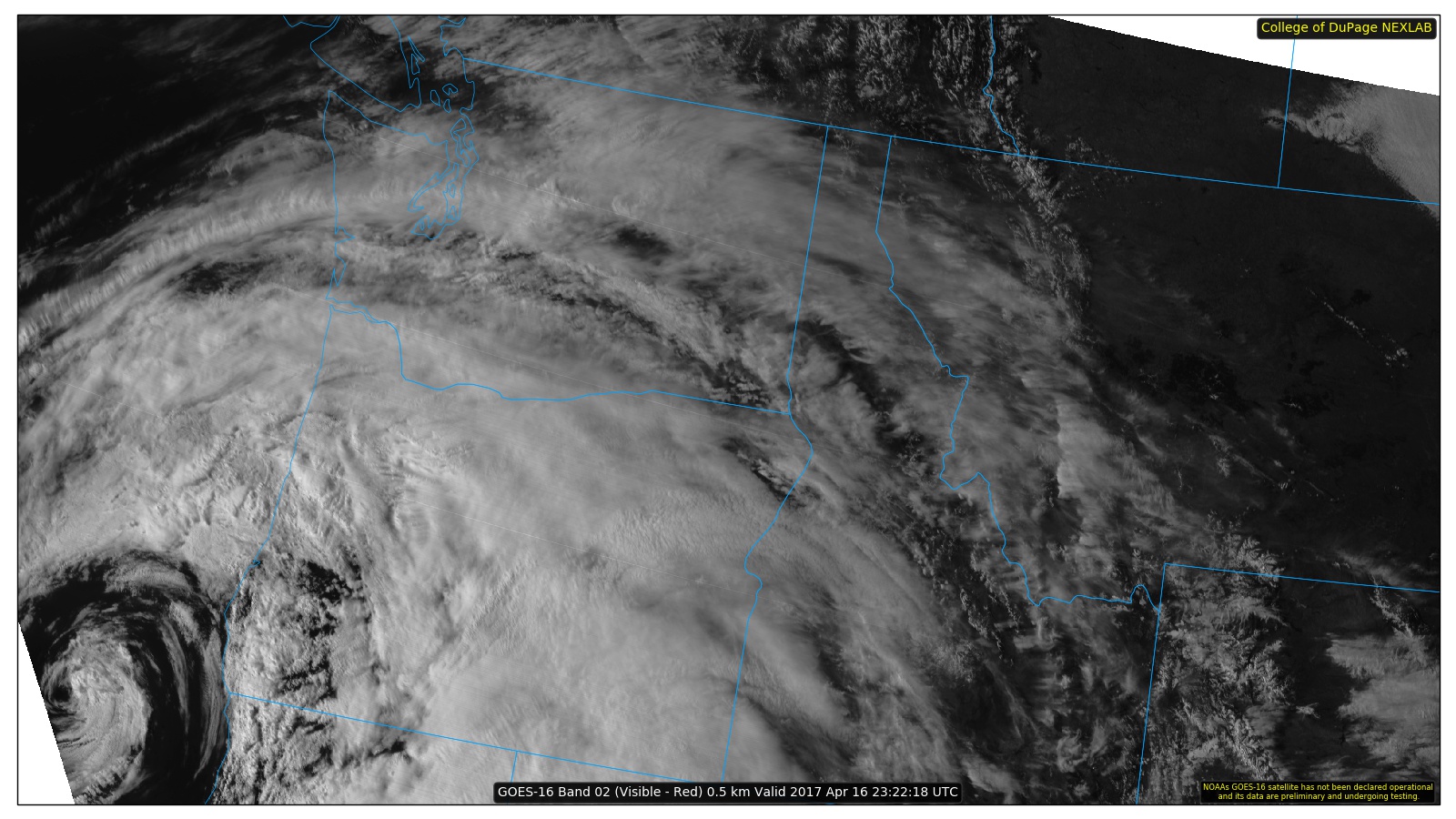
NEXLAB Experimental Satellite -- Visible Imagery for Pac. Northwest US (GOES16)
A GOES-16 satellite image of the Pacific Northwest, showing cloud cover over much of the region, via a website created by the College of DuPage.
The new GOES-16 weather satellite has been in orbit since November 16, 2016 and some of the imagery is available in real time. It is marvelous. The spatial resolution of the imagery is higher than the current operational weather satellites, but what really is a game change is the frequency of observation, with new images every 5 minutes versus every 15 minutes for the current operational systems.
Animation:
"American minds are not ready to think about how fast democracy could disintegrate," Tom Nichols…
"Voters in states across the political spectrum have backed abortion rights since the fall of…
"Thousands of planes and ships are facing GPS jamming and spoofing. Experts warn these attacks…
Time's Eric Cortellessa was granted multiple audiences with Donald Trump and wrote a chilling report…
"While court proceedings are likely to delay implementation of the ruling, the political impact was…
Watch highlights from the seventeenth episode of SNL’s forty-ninth season, hosted by Ryan Gosling, with…