
British Columbia’s Greater Vancouver and Lower Mainland population centers are currently cut off by land from the rest of Canada after an “atmospheric river” caused severe flooding of rivers in the Cascade and Coast mountain ranges.
The “province on the Pacific” was just beginning to recover from a summer of record heat, and wildfires which ravaged the Fraser Canyon town of Lytton and threatened the ranching community of Merritt with evacuation.
Merritt, a ranching town of 7,000, is a place where I and Rockies-bound hiking buddies regularly stop for lunch while traveling the Coquihalla Highway, the main route for recreational and commercial travel into interior British Columbia.
All the town’s residents were being evacuated Tuesday to Kelowna and Kamloops. The Coquihalla is closed due to a massive washout.
Asked about highway closures, British Columbia Public Works Minister (and acting Premier) Mike Farnworth told reporters: “In some cases, it can be hours, or a day to remove debris. But in some cases, like the Coquihalla, it could be several weeks or months.”
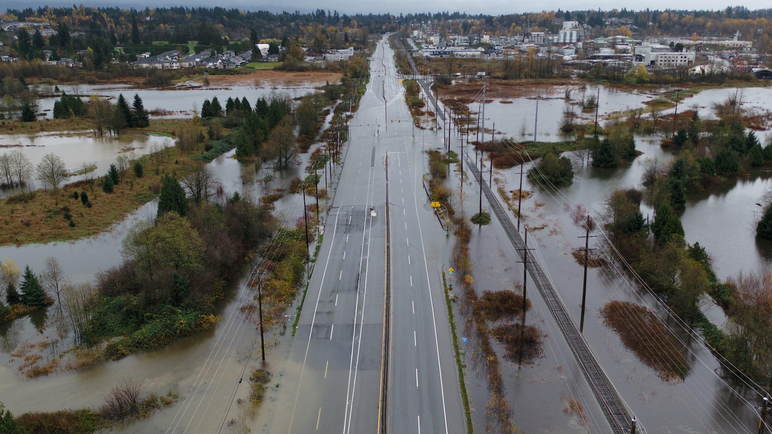
What happened? The “atmospheric river” off the Pacific scored a direct hit on Whatcom County and the lower Fraser River valley. Floodwaters covered the TransCanada Highway north of the border towns of Sumas. Much of Abbotsford has been evacuated due to failure of a pumping station.

Further east, the town of Hope is found at the junction of five major highways, three leading into the interior. It also sits beneath 6,900-foot Mt. Cheam and other peaks of the Lucky Four group.
Hope received 8.55 inches of rain from the atmospheric river. The town has been cut off with highways flooded in all directions. An estimated 250 stranded motorists were holed up at Grace Baptist Church.
West on Highway 7, which runs north of the Fraser River, more than three hundred people (and twenty-six dogs) had to be airlifted out of the flood’s way. Both Highway 7 and the TransCanada Highway, headed downstream, were closed by flooding. Upstream, landslides closed the north and eastbound TransCanada Highway in the Fraser Canyon, and Highway 3, the southern Trans Provincial Highway which passes through the Cascades.
About 110 miles east of Vancouver, on the Trans Provincial Highway, the town of Princeton (population 3000) found itself half flooded from waters of the Similkameen River, with no potable water, and with a ruptured gas line. Mild weekend weather gave way to sub-freezing temperatures.
On Vancouver Island, the dramatic Malahat Highway north of Victoria was closed for twelve hours a day, and open to one-way car caravans, as debris were cleared.
The era of climate damage has hit hard at a province once nicknamed Canada’s “lotus land.” Moderating winter temperatures in remote reaches of the Chilcotin Plateau increased the pine bark beetle population, killing hundreds of miles of forests stretching north and east. A Vancouver-to-Terrace flight yields views of orange (dying) and gray (dead) Lodgepole pine forests.
The dead forests have fed wildfires, from the village of Telegraph Creek, on the Stikine River just above the Alaska border, to Kootenay National Park near the Alberta border in the Canadian Rockies.
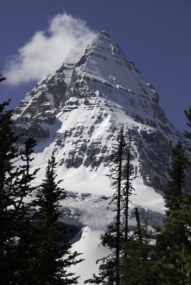
In the summer of 2018, our party bound for Mount Assiniboine traveled six hundred and twenty-eight miles, through smoke from four major fires, to Canmore, Alberta. British Columbia Premier John Horgan has spoken of the fires as a “new normal.”
The “heat dome” last June yielded Canada’s all-time temperature record of 49.6 degrees Celsius or 121.3 degrees Fahrenheit in Lytton.
Days later a “wall of fire” burned ninety percent of the community.
All told, during the heat wave, British Columbia experienced 486 deaths compared to 165 in a period of normal temperatures.
The main population centers of British Columbia are flanked to the north by the Coast Range, to the east by the Cascades. The peaks squeeze atmospheric rivers, especially in places like Hope and the area around Squamish north of Vancouver.
Visitors see spectacular waterfalls in summer but can confront raging rivers during fall storms and sudden spring runoff.
A test of British Columbia’s “Alert Ready” cell phone emergency warning system was scheduled for Friday, but was canceled due to the ongoing, real emergency.